Sparta: week6
Plans

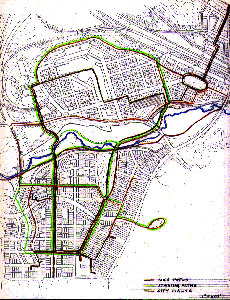
Bike paths are rust brown and connect residential areas,schools, offices and Metro. Jogging paths are lime green and connect residential areas with work places through the park system. City walks are gold and connect places such as the farmers' market, parks, outdoor cafes, Metro, the mall, day care and playgrounds.

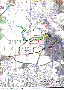
Gwynns Falls regional hiking trail is in light green, connecting Gywnns Falls with Soldiers Delight through Owings Mills. The historic path is in purple and connects the Fulling mill ruins and Owings Mills House to the McDonogh pumping station, the 1690's land grant building and the 1830's house. The trout path is in dark green and follows the trout stream. The bike path is in rust brown and connects residential areas, schools, offices and the Metro.
Sections
Elevations
Perspectives
Models

