| Gigi
Saltonstall • Mapping |
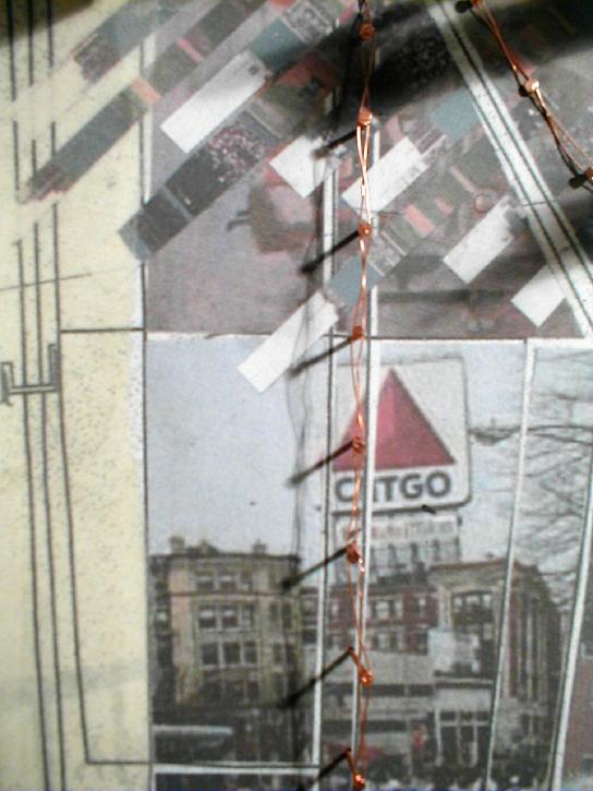
My map denotes three routes around and through the Back Bay Fens. As a child
in Boston I never entered the park but passed by it or drove around it on
many occasions. It was a blur as the T rattled by. Pedestrians or bikers
are not the only ones that are affected by the Fens; it does not take entering
the technical grounds of the park to understand something of its presence.
And it could be argued that more people in the Boston area understand the
park from high-speed modes of transportation such as car or T than people
do on foot. My mapping is loaded with personal associations as understood
by a resident. It becomes clear that the Back Bay Fens is more then a park,
it is a receptacle. It has physically received material (garbage as landfill),
it has housed plant animal habitats and people as well. But it has also
received much from the community at-large and its image is tied to the institutions
and neighborhood around it. This perception includes a wide variety of influences
from Kenmore Square with its flashing Citgo sign to Fenway Park and the
Boston Red Sox, from the Boston Museum of Fine Arts and Isabella Stewart
Gardner Museum to the many colleges and universities that surround it. The
Emerald Necklace has long dealt with modes of transportation and the time
spent moving from one place to the next. It is important to think of how
this landscape is consumed as people move along, across, and through it,
not just on foot. With this in mind, I have taken my mapping to begin to
think about a new design. |