|
|
||||||||||||||||||||||||||||||||||||||||||||||||||||||||||||||||
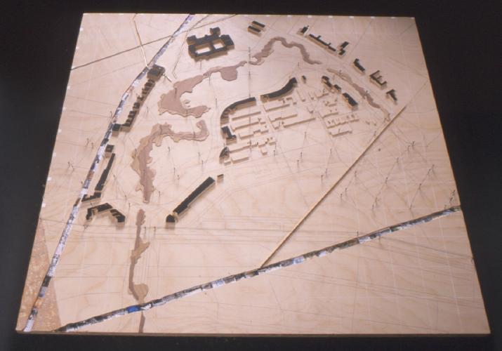
| Jerald Sparkman • Mapping | The first mapping exercise reflects an attempt to understand the relationship(s) between the seen and unseen systems of the Fens and adjacent areas. The park, roads and buildings structure the urban context in a manner that is perceived, on one level, by the physical qualities of the city. The movement of the sun across the site and the underground municipal systems such as the storm water and sewer systems also shape the city in equally provocative yet, perhaps, more elusive ways. • The watercourse is represented with two different wood veneers that distinguish between the current configuration of the water and the outline of the Fens in the 1920's. The lighter veneer, showing the Shurtcliff design, indicates some of the idiosyncrasies of Olmsted's original design. • The Mill Dam (Beacon St.) and Cross Dam (Hemenway St.) are routed into the base and covered with images relating the influence of industry and cultural institutions on the structure of the urban context. These grooves suggest a depth to the adjacent land, pointing to the history of human involvement with land making in this area. • Suspended above the map is a diagram charting the course of the sun for each month of the year at each hour of the day for the Boston latitude. This part of the map is intended to draw out correlations between the light and dark areas of the site and their respective uses. • Wires laid in narrow grooves indicate the below ground presence of municipal systems and their coincidence with above ground structures. |
|
|
|
| continue | |
| Copyright ©Kathy Poole all rights reserved |