| Leigh
Fitts • Mapping |
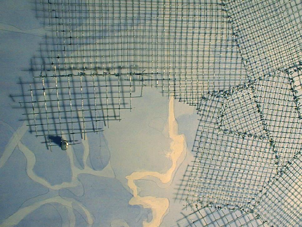
The purpose of my mapping exercise is to show the changes of the outline
of the land and water of the Back Bay Fens since 1795. Land has been both
added and subtracted in this area. For this reason, I decided to combine
various outlines of the landform from different points in time on the same
map. However, each wash does not represent a specific point in time. The
areas of the map that are built up with the most layers of wash are the
areas that have been land for the longest period of time. And the areas
that contain no wash are the areas that have been water for the longest
period of time. The metal screen overlay begins to show the grain of the
city, in both scale and direction. It also begins to designate the edges
where different graining patterns meet. |