They contain many of the functions and aspects
of a city such as living, working, shopping, even occasionally, civic
activities, but there is no hint of the principle, so key to the
definition of the traditional American city or town, of the street as a
pedestrian public space.
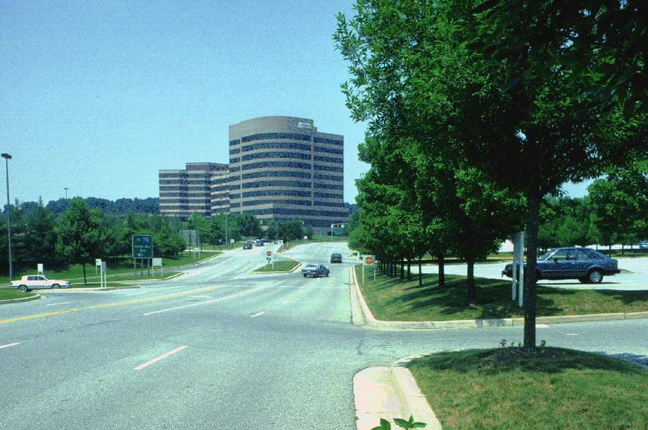
Red Run Blvd. in Owings Mills; note the enormous size of the street
and lack of sidewalks.
Similarly, they have contributed to many of the environmental problems that continue to confront our society; their near total reliance on automobiles has resulted in massive traffic congestion and air pollution, vast parking lots and roadways degrade water quality through the contamination of stormwater runoff and their sprawling character aggravates the loss of farmland and rural character.[3]
Assuming that the American city will continue to develop in this dispersed, multi-centered manner, the edge city remains very much an incipient form in need of serious design consideration. The challenge to designers is to aid in the reinvention of these places as cities in a more mature configuration, ones which have an urban form governed by the needs of pedestrians as well as cars and that are environmentally sustainable. Within this pattern that continues to spread across the American landscape, Owings Mills, MD is a place that while it displays all of these characteristics of an edge city, is still in an incomplete form. It, therefore, presents a useful opportunity to consider the design possiblities assuming a different method of design and development.
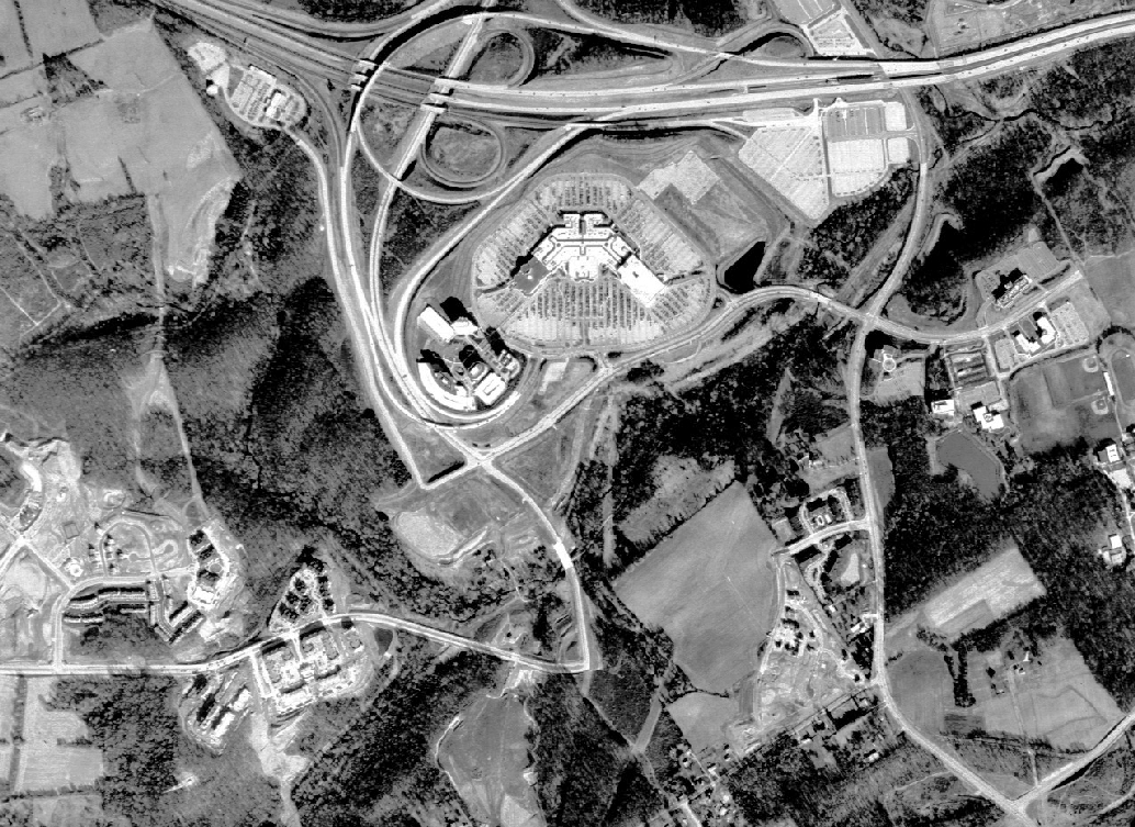
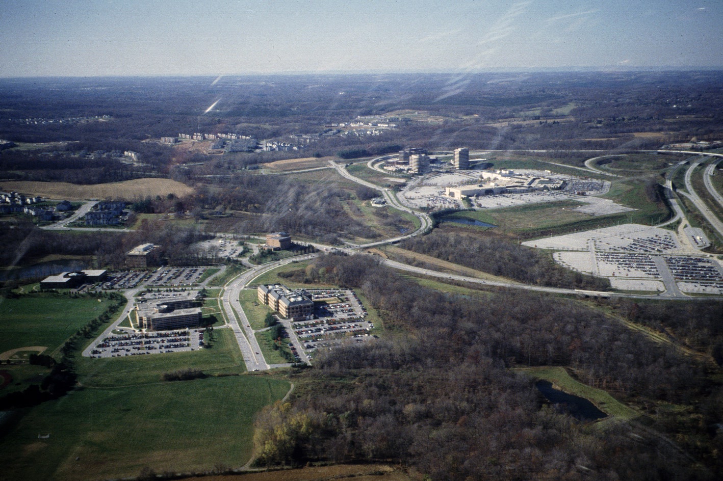
At present, the site contains several elements associated with the
typical edge city; a regional shopping mall ("Owings Mills Town Center"),
a large planned unit development ("Owing Mills New Town") and a corporate
office park ("McDonogh Corporate Campus"); all adjacent to an interstate
highway and the terminus stop of the Baltimore Metro, but lacking any
spatial connections between these elements.
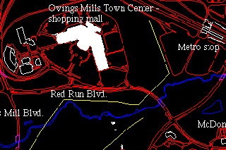
Locator Map of Existing Site Elements
Image Map of existing site views
View an oblique aerial video of the "Town Center" area.
Numerous other proposals have been made for the area which, were they to be built, would result in another Tyson's Corner, VA, perhaps the quintessential edge city. Fortunately, the economic recession has intervened to slow the headlong rush of speculative building and allow time for the consideration of other options. The key areas that were the focus of this study were primarily those bounded by the highway, Owings Mills Blvd., Lyons Mills Rd. and Painters Mill Rd. This is the area that constitutes the underdeveloped, or undeveloped in the case of the hillside across from the mall, core of the future city of Owings Mills.
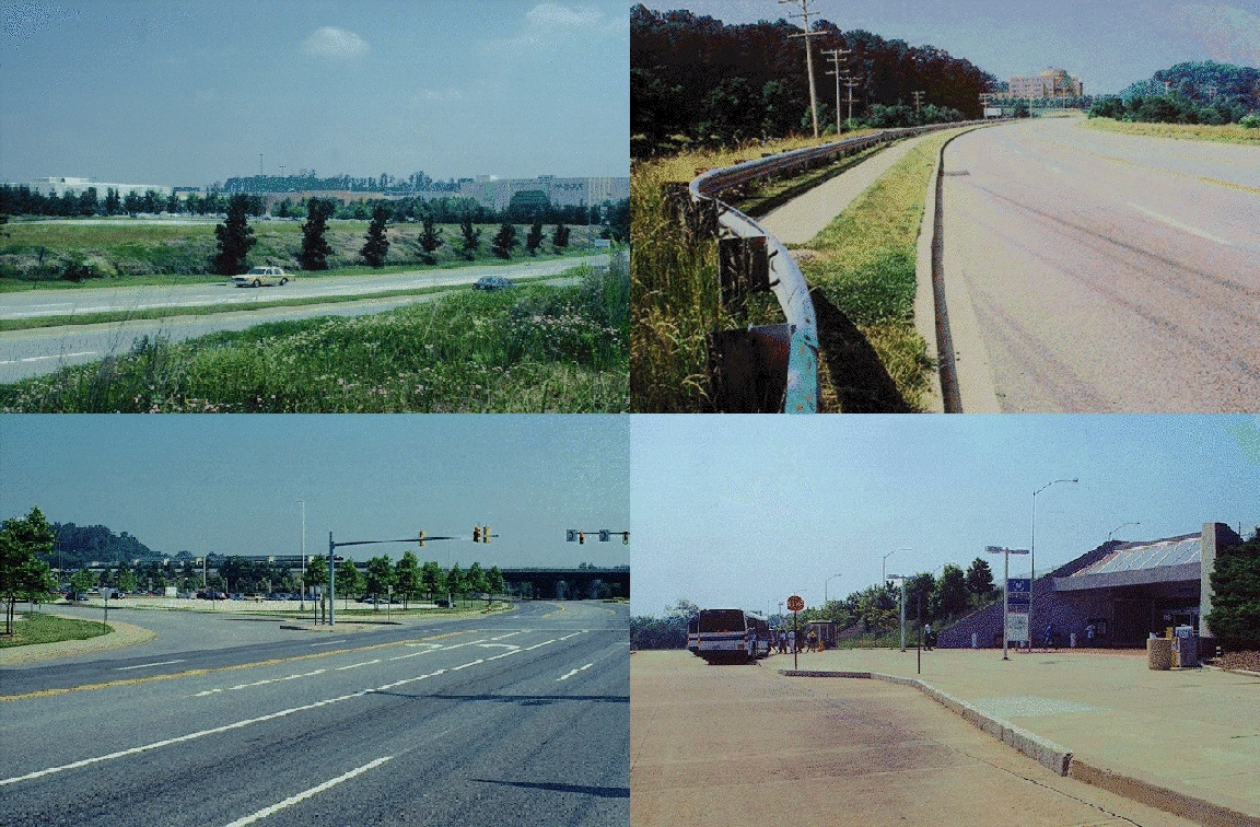
Views of shopping mall, office park, highway and metro entrance

The preservation of Red Run is a condition, mandated by the U.S.
Army Corps of Engineers and the EPA, of any further development in the
area. Because
of the extreme sensitivity of trout to water quality, this condition
places a great priority on the control and treatment of stormwater runoff
from any adjacent development. In particular, trout are very sensitive
to water temperature which precludes the use of traditional methods of
stormwater retention in holding ponds because this would allow the water
to be heated to much before entering the Red Run. the existing drainage
swales on the northfacing slope opposite the shopping mall must also be
preserved with a minimum 150' corridor according Baltimore County's own
stream preservation requirements.
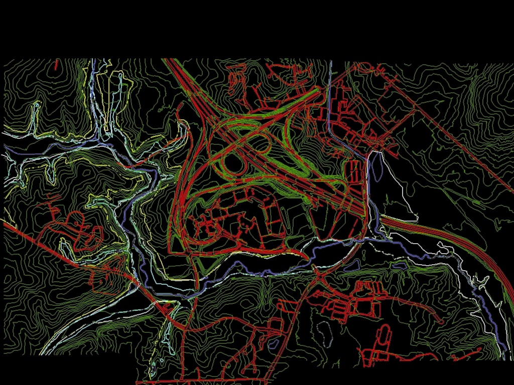
Map of stream valley floodplain(white line) and forest buffers
(yellow line)
Future development of a city on this site
must be predicated on a new concept of urban infrastructure which sees
the functional needs of the city and the natural environment as equally
important. The design of this infrastructure system and its integration
into the urban design and open space system was a key aspect of the
design problem.
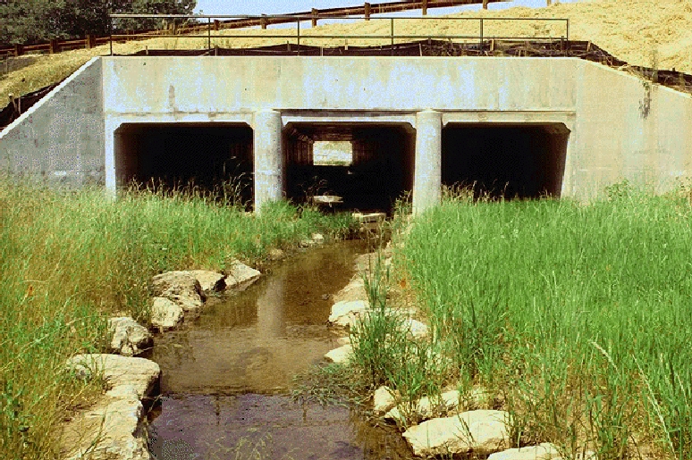
New stream crossing with reconstructed trout habitat at Owings Mills New Town
 IATH WWW Server |  Introduction |
 Send Comments |
 Image Map